
Thanks For The Visit !


www.farmboyzimsflightsims.com
FBZFS
FBZ's Fast Flight's
Greenland - The Arctic Region
Greenland - The Arctic Region
Here we go, off on another of “Farmboyzim’s Fast Flight’s”! These are flights in areas around this big blue marble of ours that we live on that deserve attention, in both the real world and the simulated world. I'd like to try to help to keep you informed on some environmental issues, as well as turning you onto some great sceneries and aircraft. I like to think this is a win-win situation, as we do our part to help the environment and you just might discover an area within MSFS that has gone previously unexplored!
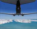
This time around, we are going to head over to Greenland, and see for ourselves (virtually of course!), just what is going on with the North Polar Ice Pack and the Ice Sheet that covers Greenland. So put on your thermal underwear, crank up the heat in the cockpit, don’t forget to turn on the pitot heat, and settle in for an adventurous and chilly flight in the great northern expanses!
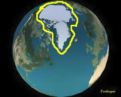
In particular, we are going to talk about the Greenland Ice Sheet, which is the second largest body of ice in the world, the first being the Ice Sheet that covers Antarctica and the South Pole. Eighty percent of the continent of Greenland is covered by this sheet of ice, which is around 2 kilometers thick, and up to 3 kilometers at its thickest. You’ll also find a glacier here and there, along with isolated ice caps (which are technically smaller than Ice Sheets) around the coastal waters of Greenland. These
This time around, we are going to head over to Greenland, and see for ourselves (virtually of course!), just what is going on with the North Polar Ice Pack and the Ice Sheet that covers Greenland. So put on your thermal underwear, crank up the heat in the cockpit, don’t forget to turn on the pitot heat, and settle in for an adventurous and chilly flight in the great northern expanses!
In particular, we are going to talk about the Greenland Ice Sheet, which is the second largest body of ice in the world, the first being the Ice Sheet that covers Antarctica and the South Pole. Eighty percent of the continent of Greenland is covered by this sheet of ice, which is around 2 kilometers thick, and up to 3 kilometers at its thickest. You’ll also find a glacier here and there, along with isolated ice caps (which are technically smaller than Ice Sheets) around the coastal waters of Greenland. These
bodies of ice make up an additional 80,000 square kilometers or so of area covered in ice. These sheets of ice formed due to the higher latitude regions soaking up less of the solar radiation from the sun than the regions around the equator. This of course results in lower surface temperatures. Hence, one huge ice cube!
The current sheet of ice that covers Greenland is approximately 110,000 years old. The unthinkable amount of weight from this ice sheet has depressed the central area of Greenland, with most of the actual continent, minus the ice, being at or around sea level. The region does have some interesting terrain, but is not as dramatic as, for example, the Everest region. The actual continent itself, under all that ice is slightly depressed because of all the weight it is packing. I would be too!
The current sheet of ice that covers Greenland is approximately 110,000 years old. The unthinkable amount of weight from this ice sheet has depressed the central area of Greenland, with most of the actual continent, minus the ice, being at or around sea level. The region does have some interesting terrain, but is not as dramatic as, for example, the Everest region. The actual continent itself, under all that ice is slightly depressed because of all the weight it is packing. I would be too!
The North Pole is actually covered in what is called pack ice (sea ice). This pack ice changes with the seasons, some of it melting away. Portions that do not melt away with the warming of the summertime months get fairly thick, up to 3 to 4 meters over large areas. The “one-year” ice ranges around a meter thick. Ever see a movie with a submarine breaking through the pack ice? Quite the site! These guys are cruising along underneath this immense sheet of ice.
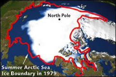
The arctic region has been likened to the canary in the coal mine. For those of you not familiar with this term, canaries were kept down in coal mines for detection of toxic gases. The birds were the first succumb to the gases, alerting the miners that there was poisonous air in the mine. Scientist’s are watching the Arctic closely for it’s a highly sensitive region, and it is being dramatically impacted by our changing global environment. Temperatures in the Arctic are rising twice as fast there as anywhere else in the world.
The largest single block of ice in the Arctic is the Ward Hunt Ice Shelf, and it’s been around just a bit longer than I have, around 3,000 years. Back in 2000, it started to crack, and within just two years has split in two and is crumbling apart. It’s obvious that something major is happening that is causing these types of events all around the world, not only around the poles, but in the high mountainous regions on the earth as well. Mt Kilimanjaro in Kenya, with its vanishing snow cap is an example.
The Ward Hunt contained a rare, fresh water lake situated on its ice shelf. When it cracked, this water drained away into the ocean, destroying a very unique ecosystem, as well as upsetting the feeding and migration habits of whales, polar bears, seals, birds, as well as humans. Many native peoples of the arctic regions rely on these species for their survival. These folks view the global warming problem as a very real threat to both their existence and their culture.
Greenland is a continent that is inhabited primarily on its coastal areas. You’ll find most of the areas of human habitation on the west coast (thirteen “cities” are represented in MSFS, with only a couple of those capable of handling anything in the “heavy” range). The interior of Greenland is far too inhospitable to maintain any ongoing human existence. The massive sheet of ice that covers Greenland contains ten percent of the world’s fresh water, give or take an ice cube tray or two. Most scientist’s believe (I suppose there are a few hold outs!) that the current pace of global warming will cause the ice sheet that covers Greenland, the ENTIRE ice sheet, to melt within a hundred years. If this in fact happens, there will be a global rise of oceans somewhere in the vicinity of 23 feet. Needless to say, this would cause major problems around the globe, for communities that are situated on the coasts. Also impacted would be small islands, such as the nation of Maldives in the Indian Ocean, some of which is just a few feet above sea level. These areas would literally be washed off the face of the planet.
Greenland is a continent that is inhabited primarily on its coastal areas. You’ll find most of the areas of human habitation on the west coast (thirteen “cities” are represented in MSFS, with only a couple of those capable of handling anything in the “heavy” range). The interior of Greenland is far too inhospitable to maintain any ongoing human existence. The massive sheet of ice that covers Greenland contains ten percent of the world’s fresh water, give or take an ice cube tray or two. Most scientist’s believe (I suppose there are a few hold outs!) that the current pace of global warming will cause the ice sheet that covers Greenland, the ENTIRE ice sheet, to melt within a hundred years. If this in fact happens, there will be a global rise of oceans somewhere in the vicinity of 23 feet. Needless to say, this would cause major problems around the globe, for communities that are situated on the coasts. Also impacted would be small islands, such as the nation of Maldives in the Indian Ocean, some of which is just a few feet above sea level. These areas would literally be washed off the face of the planet.
The United States Pentagon jumped on the bandwagon back in October of 2003, when they released a report entitled, “An Abrupt Climate Change Scenario and Its Implications for the United States National Security”. Whew, that’s a mouthful! The bottom line of the report is that with abrupt changes in climates, so may blow the winds of war, along with other nasty things, due to food and water shortages, uninhabitable regions around the globe, etc. It’s a very sobering read, but it does take the “dark side” of the issue to what is only a possible scenario. Nothing is written in stone! We can all make a difference, no matter how small we may think the effort would be, just do it! It all adds up!
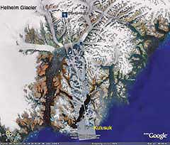
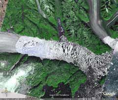
On the eastern coast of Greenland, about seventy five miles from Kulusuk, Greenland, on an almost perfect magnetic North heading, is the Helheim Glacier. Studies indicate that this chunk of ice rapidly breaking up and thinning substantially as well. Between the years 2001 and 2003, over 40 meters were lost in thickness. It is complicated to get a really good grasp on future changes in the region due to the ever changing relationships of temperature, ice flow rates and thickness, but the overall opinion is that events will continue to accelerate without a change for the better.
I do believe that the solution to these problems can be helped immensely by you and me, doing what we can across the lands and seas, to ensure that these beautifully unique areas change as little as possible. Change is inevitable, but let’s not let it happen for the wrong reasons! In this game, we are ALL on the same side!
I do believe that the solution to these problems can be helped immensely by you and me, doing what we can across the lands and seas, to ensure that these beautifully unique areas change as little as possible. Change is inevitable, but let’s not let it happen for the wrong reasons! In this game, we are ALL on the same side!
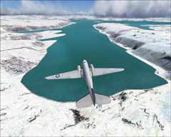
OK, now the fun stuff! There isn’t a lot in the way of sceneries for the Arctic regions, Greenland in particular, but what I did find certainly enhanced the area to make for a better flight. I installed a freeware terrain mesh of Cape Farvel, Greenland, which is on the southern tip of the continent. According to the author of the Mesh, Andreas Trawny, this was the only area covered by SRTM data at the time of its creation, back in 2004, the actual data based on a shuttle mission of in February of 2000. The effects are definitely better than the default mesh, with loads of dramatic peaks and valleys. A few areas looked a bit “table-top” in the way they were rendered, but looking at the Google Earth image of the area, it does a pretty good job and gives you a better sense of what the region is like. The name of the file is cape_farvel_srtm.zip.
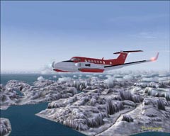
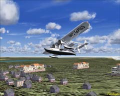
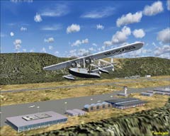
Another nice addition in the freeware scenery department is the file greenland_ports_and_docks_v2.zip, which was put together by Halfdan Abrahamsen. This scenery adds quite a bit of coastal inhabited areas to Greenland, as well as the two airports of Narsarsuaq and Kangerlussuaq (Sondre Stromfjord). Together with Thule in the far North, these airports are the only Greenlandic ports serving large jets, and they are both used for Greenlandic traffic and as fuel stops on trans-Atlantic flights. A host of heliports and settlements are also included. A couple of fishing camps are tossed in for your angling enjoyment as well. Halfdan also has done a number of repaints for the default aircraft in MSFS, covering Air Greenland and Air Alpha liveries. The aircraft repainted are the smaller aircraft, which are used around the region for a number of requirements, and the are Cessna Skyhawk 172SP, Beech King Air 350 (in real world it’s a 200), Cessna 208 Caravan, and the Cessna 208 Caravan Amphibian. Very nice paints on all.
Another nice addition in the freeware scenery department is the file greenland_ports_and_docks_v2.zip, which was put together by Halfdan Abrahamsen. This scenery adds quite a bit of coastal inhabited areas to Greenland, as well as the two airports of Narsarsuaq and Kangerlussuaq (Sondre Stromfjord). Together with Thule in the far North, these airports are the only Greenlandic ports serving large jets, and they are both used for Greenlandic traffic and as fuel stops on trans-Atlantic flights. A host of heliports and settlements are also included. A couple of fishing camps are tossed in for your angling enjoyment as well. Halfdan also has done a number of repaints for the default aircraft in MSFS, covering Air Greenland and Air Alpha liveries. The aircraft repainted are the smaller aircraft, which are used around the region for a number of requirements, and the are Cessna Skyhawk 172SP, Beech King Air 350 (in real world it’s a 200), Cessna 208 Caravan, and the Cessna 208 Caravan Amphibian. Very nice paints on all.
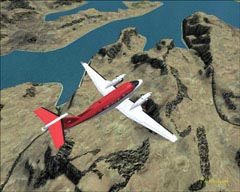
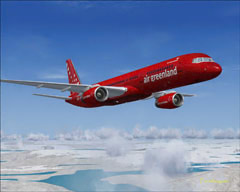
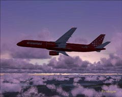
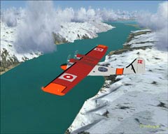
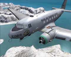
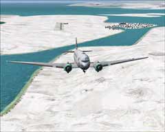
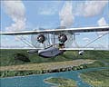
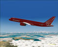
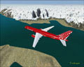
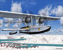
There are quite a few repaint textures out there representing Air Greenland, a commercial airline carrier. The big boy in the screenshots is a repaint of Project Opensky’s Boeing 757-200 in Air Greenland colors, file name po75agrn.zip. Gerry McLaughlin did the paint job on this bird. Another very cool aircraft used here was the FS2004 Sikorsky S-38 'Untin' Bowler 75th Anniversary Edition. This aircraft is a twin-engine amphibian, designed and produced by Sikorsky, and designated S-38B. Long story short, two notable individuals wanted to try to establish a northern route from Chicago to Berlin. They gave it a go in the S-38 but she was battered about and destroyed by drifting ice flows in a harbor. They got as far as Labrador, and in 1929, even this was no small accomplishment! This model, file name of s38bowl4.zip, comes to you courtesy of George Diemer. I have to say, I love this model! Very unique! Included in the readme file is some very interesting info on the actual flight attempt and the aircraft itself. There’s also a decent model of a PBY-5 Catalina representing Denmark. It was utilized for Search and Rescue (SAR) and photo mapping missions. Model is by Mike Stone and the repaint is by Michael Hoestrup. This particular file is named rdafpby5.zip.
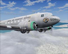
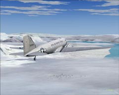
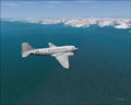
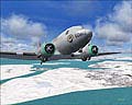
Last, but certainly not least (saved my favorite for last!), is the Mid-Atlantic Air Museums (MAAM-SIM) Douglas R4D / DC-3, sporting the livery of the United States Naval Air Transport Service. Paint job courtesy of Mark Beaumont, who is with MAAM-SIM. This was the only payware aircraft in this article, but I do want to mention that the proceeds of the sales of this model, is put toward restoration efforts and other Museum needs. A worthy cause! A beauty of a model! The reason this model is tops in my favorites category, is I had the opportunity, pre-FAA restrictions, to fly a real DC 3, only for about fifteen minutes or so, but man-oh-man! What a ride!!! Excellent model and loads of repaints! Give them a visit over at www.maam.org.
I would like to thank the folks at Flight1 (Ground Environment Pro and Flight Environment) and Calibre Software Solutions (Weather Maker RX) for providing me with the products to make my virtual flying as excellent as can be! To all Freeware designers as well, keep up the great work! It IS appreciated!!!
I hope you enjoy flying in the brisk northern regions! I also hope that you take a bit of the information that you read here away with you, and perhaps spread the word that we all have to start taking better care of good old Mother Earth! For the next Farmboyzim Green Flight we will take a peek at the Rain Forests in South America, and the impact that lumber harvesting is having on the region, as well as the globe. Oh yeah, let’s not forget some leads on Scenery and Aircraft as well.
Let’s keep the “Real World” as pristine as our “Virtual World”, and always, have a great flight!
FBZ \l/
One other file that you should have if you are going to be flying in Greenland is greenland.zip for FS2004, by Toni Agramont. Toni did a great job adding a few villages, fishing boats in harbors, and additional airfields and heliports to the country of Greenland. Loads of very colorful buildings and some really nice work on the airports and airfields are just what this area needed! The default scenery for mostly all of the arctic is rather bland in MSFS, to say the least, and these scenery "freebies" really add some character to that cold continent.
I got a bit frustrated when I loaded up greenland.zip, and most of the textures on the buildings were missing. You may have seen it before, the plain gray look. After banging my head on the table and taking another look at the files involved, I figured out what the problem was! Within the "Texture" file that you paste into addon scenery folder, you will see some zip files hiding out. You need to extract the contents (which are additional textures) right there into your "texture" folder, along with all the other .bmp files. Problem fixed! These zip files were not mentioned in the "readme" file that came in the scenery folder. It took a while to get it figured out, but it was well worth the effort!
I got a bit frustrated when I loaded up greenland.zip, and most of the textures on the buildings were missing. You may have seen it before, the plain gray look. After banging my head on the table and taking another look at the files involved, I figured out what the problem was! Within the "Texture" file that you paste into addon scenery folder, you will see some zip files hiding out. You need to extract the contents (which are additional textures) right there into your "texture" folder, along with all the other .bmp files. Problem fixed! These zip files were not mentioned in the "readme" file that came in the scenery folder. It took a while to get it figured out, but it was well worth the effort!
Cape Farvel area of Greenland
Substantial ice loss
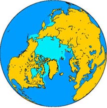
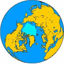
North polar ice cap and Greenland
North pole February ice-pack 1978-2002
North pole September ice-pack 1978-2002
The Helheim Glacier
Image courtesy of Google Earth
Image courtesy of Google Earth
The Helheim Glacier as seen in
MSFS 2004. Not quite as dramatic as the real thing.
MSFS 2004. Not quite as dramatic as the real thing.
Close up of the Helheim Glacier
Image courtesy of Google Earth
Image courtesy of Google Earth
Winter Textures
Summer Textures
Air Greenland Livery
We don't want to see it like this!
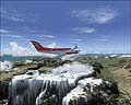
The added scenery is a plus
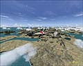
Narsarsuaq
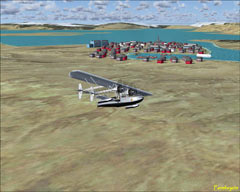
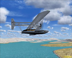
Sikorsky S-38 "Untin Bowler"
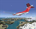
Population of Greenland is mostly coastal
Project Opensky’s Boeing 757-200
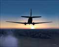
Beautiful sunset over the Arctic
The "Untin Bowler" flying over the area where she was crushed and sank
The PBY-5 Catalina sporting the Danish colors in a SAR role
MAAM-SIM's Douglas R4D/DC-3
Naval Air Transport Livery
Naval Air Transport Livery
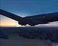
Crisp, clear, and very, very, very cold!
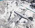
This bird knows the north all too well!
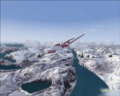
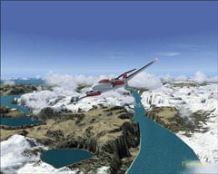
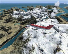
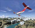
Leaving Kulusuk for the Helheim Glacier